Population density, a critical demographic metric, quantifies the number of individuals residing within a specific geographical area. Understanding this concept can illuminate regional demographic dynamics, aid in urban planning, and inform resource allocation. This guide provides expert insights into calculating population density, backed by real-world examples and actionable recommendations.
Key Insights
- Population density measures individuals per square kilometer, offering insights into urbanization.
- Accurate data collection and geographical delimitation are essential for reliable results.
- Utilize online tools or software for precise calculations and map visualization.
Understanding Population Density
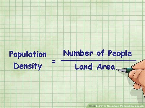
Population density is defined as the number of people living per unit of area, typically square kilometers or miles. This measure provides a snapshot of how crowded or sparsely populated an area is. A high population density signifies densely populated urban centers, whereas a low population density typically characterizes rural areas. Calculating this metric allows urban planners and policymakers to understand spatial demographic distributions, guiding decisions on infrastructure development, healthcare, and social services.Methods for Calculating Population Density
Calculating population density involves straightforward yet meticulous steps. Start with obtaining reliable population data, often sourced from national censuses or governmental databases. The next step is defining the area of interest, which may vary depending on the purpose of your analysis—be it at a local, national, or global scale. Using these data points, the formula for population density is simple: divide the total population by the area in square kilometers or miles.For example, if a city has a population of 1,000,000 and covers an area of 500 square kilometers, its population density would be calculated as follows: 1,000,000/500 = 2,000 people per square kilometer. This simple calculation can offer profound insights, such as identifying regions requiring more public services or pinpointing areas with potential for future growth.
What is the importance of accurate data in population density calculations?
Accurate data is paramount for reliable population density calculations. Errors in either the population or area figures can significantly distort results, leading to incorrect assessments of urban versus rural areas. Ensuring data is current and collected through validated methods guarantees more precise and actionable insights.
How can technology enhance population density analysis?
Technology, particularly Geographic Information Systems (GIS) and online mapping tools, can enhance population density analysis by providing dynamic visualizations and precise spatial data integration. These tools facilitate the mapping of population density across various scales, offering more detailed insights and aiding in strategic planning.
Mastering the calculation of population density offers invaluable insights into demographic patterns and spatial distributions. By following the outlined steps and utilizing technological tools, professionals can derive actionable insights that inform urban planning, resource allocation, and policy-making. This knowledge equips cities and regions to meet the needs of their inhabitants more effectively and sustainably.